"De omnibus dubitandum."
Hi and welcome to my website, I hope you enjoy your visit, I hope to add loads of stuff as I go on. I will be adding loads more in the coming weeks/months/years so keep checking.
At the moment I have a section on the History of Wrexham, Buildings and Places of Wrexham Past and Present, Villages and Places around Wrexham, Broughton Community, The Moss Valley and Gatewen Hall.
Please feel free to email me here with any questions, advice or photos you would like to add.
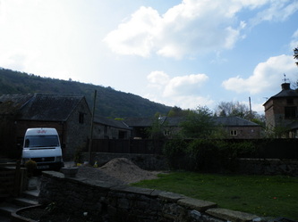
The above photo is of my families bus company called Guy's buses.
For Pentre Broughton, Moss, Brynteg, New Broughton, Caego, Lodge and Southsea please go to my Broughton Community page.
Villages and Places around Wrexham
Acton
Acton lies in the north-eastern part of Wrexham. The area is largely residential and at its centre, lies Acton Park, the location of the former Acton Hall.
Acton was originally one of the townships of the parish of Wrexham (in 1886, the township was transferred to the new ecclesiastical parish of Rhosddu). Under the civil administration, the civil parish of Acton, based on the old township's boundaries, was part of the Wrexham Rural District, but was abolished in 1935 and parts were transferred to the civil parishes of Bieston and Wrexham Regis. All the latter structures were abolished under the terms of the Local Government Act 1972.
In 1985, a Boundary Commission review led to the creation of four new community areas within Wrexham itself, Acton, Rhosddu, Offa, and Caia Park, each of which would have their own community council.
The community of Acton covers approximately 3.34 square kilometres (1.29 square miles) and comprises the electoral divisions (wards) of Acton (Acton Central & Acton Park), Borras Park, Little Acton, Maesydre and Rhosnesni. The southernmost tip of the community area is on the corner of Chester Street and Charles Street in the town centre, and is bounded by Chester Road to the west, Holt Road to the south-east and the Llanypwll link road (A5156) to the north-east. At the 2001 census, it was the most populous community in the county borough with 12,960 people in 5,412 households.
The area neighbours the communities of Rhosddu to the west, Caia Park to the south, Holt to the east and Gresford to the north.
At the geographical centre of Acton lies Acton Park, the location of the former Acton Hall. The central feature of the park is the lake. It was originally constructed using puddled clay in the 18th century but during the 1970s, the pond was drained and butyl lined. Fishing is popular on the lake with platforms provided for anglers. (The lake is closed for fishing during the Wildfowl nesting period). A wetland area exists and supports a diverse range of wildlife.
A designated area managed to benefit wildlife as one of the Wrexham Bio-diversity Action Plan 'Urban Green Space' areas. Native wild meadow flowers have been planted within the existing grassed areas to assist in providing habitats for insects and other fauna , increasing the bio-diversity of the parkland.
In 2008, Wrexham County Borough Council secured Heritage Lottery Funding to allow them to prepare design prosposals for the refurbishment of the park, the ideas that have been drawn up so far are in the early stages but they include a Discovery Centre, Lakeside Pavilion and extending the bowling greens.
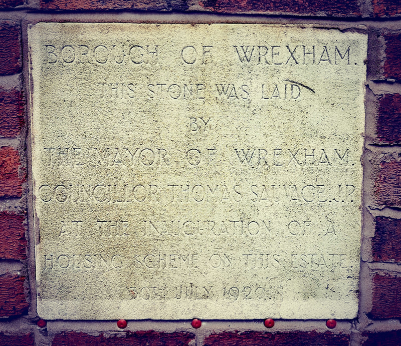
Acton Estate turned 100 Years old on July 30th . A stone was laid at No. 10 Cilcen Grove, Acton on 30th July 1920.
Rhosddu
Rhosddu is situated in the north-western suburbs of Wrexham.The name Rhosddu is formed on the Welsh words rhos, "moor" or "rush pasture", and ddu, "black". It was originally a new ecclesiastical parish formed by an Order in Council in 1886, containing the townships of Acton, Bieston and Gourton (from the parish of Wrexham), the township of Borras Riffri (from the parish of Gresford), and the township of Stansty (from the parish of Gwersyllt).
In 1972, Rhosddu reverted to the parish of Wrexham. In civil terms the area of Rhosddu was in the civil parish of Stansty, which was part of the old Wrexham Municipal Borough. The administrative structures of the Municipal Borough were abolished in 1974, under the terms of the Local Government Act 1972. Rhosddu was created as one of the communities of Wrexham Maelor after a 1985 boundary review, which brought four new 'town' communities into being within the town of Wrexham itself (Rhosddu, Offa, Caia Park, and Acton)
In 1972, Rhosddu reverted to the parish of Wrexham. In civil terms the area of Rhosddu was in the civil parish of Stansty, which was part of the old Wrexham Municipal Borough. The administrative structures of the Municipal Borough were abolished in 1974, under the terms of the Local Government Act 1972. Rhosddu was created as one of the communities of Wrexham Maelor after a 1985 boundary review, which brought four new 'town' communities into being within the town of Wrexham itself (Rhosddu, Offa, Caia Park, and Acton)
Caia Park
Caia Park was created in 1985 after a boundary commission review along with four other community areas within the town. At the 2001 census, the community had a population of 11,882 in 5,019 households.
The majority of the community area is occupied by the Caia Park (formerly Queen's Park) development of local authority housing.
Located in between Acton, Hightown and Rhosnesni in the south-east of Wrexham, this is one of the largest housing estates in Wales.
Much of the estate was laid out in the early 1950s to plans by influential town planner and architect Gordon Stephenson.
The area early on developed a reputation for social problems, and was one of two areas, along with Marseilles in France, studied in this connection by the sociologist Patricia Elton Mayo (daughter of George Elton Mayo).
According to the Welsh Index of Multiple Deprivation, the Caia Park and Queensway wards of Caia Park community are two of the 100 most deprived areas in Wales (the 5 wards that make up Caia Park are Cartrefle, Smithfield, Queensway, Whitegate and Wynnstay). The area is now part of the Welsh Assembly's Communities First project.
Caia Park Community Council has been based in the former administration buildings of Cartrefle College since 1988.
The Council runs an advice service, a community venue at St Peter's Hall, and funds environmental projects, in addition to the usual community council powers over footpaths, lighting, and input on planning matters.
Riots hit the estate in 2003; around 200 local people and 50 Iraqis were involved. 51 local residents received prison sentences.
The Pontcysyllte Aqueduct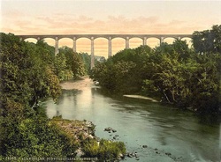
The Pontcysyllte Aqueduct (full name in Welsh: Traphont Ddŵr Pontcysyllte) is a navigable aqueduct that carries the Llangollen Canal over the valley of the River Dee in Wrexham in north east Wales. Completed in 1805, it is the longest and highest aqueduct in Britain, a Grade I Listed Building and a World Heritage Site.
When the bridge was built it linked the villages of Froncysyllte, at the southern end of the bridge in the Cysyllte township of Llangollen parish (from where it takes its name), and Trevor, at the northern end of the bridge in the Trevor Isaf township of Llangollen parish. Both townships were later transferred to Wrexham County Borough following local government reorganisation. The name is in the Welsh language and means "Cysyllte Bridge" . For most of its existence it was known as Pont y Cysyllte ("Bridge of Cysyllte"). Other translations such as "Bridge of the Junction" or "The Bridge that links" are modern, and incorrect, inventions, from the literal English translation of cysyllte being "junctions" or "links". The aqueduct, built by Thomas Telford and William Jessop, is 1,007 ft (307 m) long, 11 ft (3.4 m) wide and 5.25 ft (1.60 m) deep. It consists of a cast iron trough supported 126 ft (38 m) above the river on iron arched ribs carried on nineteen hollow masonry piers (pillars). Each span is 53 ft (16 m) wide. Despite considerable public scepticism, Telford was confident the construction method would work: he had previously built at least one cast iron trough aqueduct - the Longdon-on-Tern aqueduct on the Shrewsbury Canal, still visible in the middle of a field, though the canal was abandoned years ago. Part of what was originally called the Ellesmere Canal, it was one of the first major feats of civil engineering undertaken by Telford, by then a leading civil engineer, supervised by Jessop, the more experienced canal engineer. The iron was supplied by William Hazledine from his foundries at Shrewsbury and nearby Cefn Mawr. It was opened on 26 November 1805, having taken around ten years to design and build at a total cost of £47,000 (£2,930,000 as of 2011) |
Chirk Castle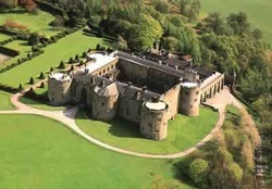
Chirk Castle (Welsh: Castell y Waun) is a castle located at Chirk near Wrexham.
The castle was built in 1295 by Roger Mortimer, 1st Earl of March as part of King Edward I's chain of fortresses across the north of Wales. Completed in 1310, Chirk is the last Welsh castle from the reign of Edward I still lived in today. Features from its 700 years include the medieval tower and dungeon, 17th-century Long Gallery, grand 18th-century state apartments, servants' hall and historic laundry.It guards the entrance to the Ceiriog Valley. It was the administrative centre for the Marcher Lordship of Chirkland. The castle was bought by Thomas Myddelton in 1595 for £5,000 (approx. £11 million as of 2008). His son, Thomas Myddelton of Chirk Castle was a Parliamentarian during the English Civil War, but became a Royalist during the Cheshire Rising of 1659. Following the Restoration, his son became Sir Thomas Myddelton, 1st Baronet of Chirk Castle. During the 1930s the Castle was home to Thomas Scott-Ellis, 8th Baron Howard de Walden, a prominent patron of the arts and champion of Welsh culture. The Myddelton family resided at Chirk Castle until 2004. Lieutenant-Colonel Ririd Myddleton was an extra equerry to Queen Elizabeth II from 1952 until his death in 1988. The castle is presently in the ownership of the National Trust for Places of Historic Interest or Natural Beauty and is open to the public between February and October. The state rooms, towers and dungeons are staffed by well informed guides. The property is also notable for its gardens, with clipped yew hedges, herbaceous borders, rockand terraces and surrounded by 18th century parkland. The magnificent iron gates are dated 1719 and bear the coat-of-arms of the Myddelton family of Chirk Castle. They are the work of the Davies Brothers, Robert and John of Croesfoel Forge, near Bersham, Wrexham and were erected between 1719 and 1721. Sir Richard Myddelton commissioned the Davies Brothers to make the gates in January 1711 - 12 and they were paid 2 shillings a day to begin with, iron being made available from Sir Richard's nearby Pont-y-Blew Forge. |
Llay
Llay (Welsh: Llai meaning meadow) is a village situated in the North West of Wrexham.
It borders several other villages including Gwersyllt and Gresford. At the 2001 Census, the total population of the community of Llay, including Llay village, was 4,905.
Prior to the 1960s, Llay was a coal mining village. Llay Main Colliery, at one time the largest colliery in Wales and after 1952 the deepest pit in the UK, was a major employer for the area before its coal reserves were exhausted in 1966.
Llay first appears in mediaeval records as a hamlet - a small settlement without a church - of the township and manor of Burton. It later formed an outlying part of the parish of Gresford, but the relatively late growth of the village is shown by the fact that the first church service was not held there until 1916, and its church was not completed until 1925.Llay was eventually made a separate parish in its own right in 1944.
Much of the growth of the village is connected with the development of coal mines, particularly the Llay Main Colliery. It was first established by the industrialist Sir Arthur Markham in 1913, but sinking of the shafts was interrupted by World War I and by Markham's death in 1916. The shafts were eventually completed in 1921, and coal production started in 1923. The colliery had a reputation as a well-run, modern pit with a relatively satisfied workforce, and by the 1930s was employing more than 3000 men, 450 families being installed in new housing schemes in Llay.
There is a country park in Llay called Alyn Waters Country Park, which has a sister country park in Gwersyllt of the same name. The site includes a children's play park and pathways for pedestrian and cycle access through the forest. There were numerous original artworks around the park such as carved wooden animals along the paths, however many of the artworks have now been stolen or destroyed. There is a small golfing range at the park, and other sporting events take place on the large playing fields, such as football (home of Llay United Youth Football Club) and archery.
There are four churches in the village of Llay; the Roman Catholic St. Francis of Assisi, Llay Community Church of the Nazarene, St. Martin of Tours of the Church in Wales and the Bethel Baptist Church.
There are two drinking establishments, which areThe Crown public house and Llay Miners Welfare, also known as Miners Welfare Institute. The Miners Welfare has bars, dancefloor with small stage and a pool hall. The Welfare had its grand opening in 1931 after negotiations in 1929 for monies to build a Miners Institute with sports facilities. The Welfare was refurbished in 2005 after receiving a grant for the work.
There is an industrial estate in Llay, being similar in size to the whole village itself, which it includes a Sharp Electronics factory.
This 8mm film used in Memories of Llay was filmed between 1964 and 1996 by G. Crowley.
Gresford
Gresford (Welsh: Gresffordd) is a situated to the North of Wrexham.
According to the 2001 Census, the population of the community, which also includes the village of Marford, was 5,334.
The former Gresford Colliery was the site of the Gresford disaster, one of Britain's worst coal mining disasters, when 266 men died in an underground explosion on 22 September 1934.
Located close to the English/Welsh border, the settlement existed at the time of the compilation of the Domesday book, when it was recorded as "Gretford".The name, having an English origin, was later recorded as "Gresworth", "Cresford" and "Grefford", but documentary evidence shows that the place was clearly locally referred to as "Gresford" throughout its history, even under Welsh administration, and the other names merely represent alternative spellings. The Welsh form "Gresfordd", from y groesfordd ("the crossroads"), seems to have been the creation of imaginative Welsh genealogists of the fifteenth century and later.
In common with many of the towns and villages of the border lands, or Marches, Gresford has gone through periods of both English and Welsh dominance. The whole area was resettled by Welsh aligned to Owain Gwynedd in 1170-1203. At this time the bishopric was transferred from that of St. Werburgh's Chester to St. Asaph, and the vicars of the village were Welsh with patronymic names (for example, Morud ap Gwarius, who became vicar in 1284). It is possible, however, that settlement existed on the site from quite an early date, as a Roman altar was found within the church in 1908. The altar is likely to depict Nemesis (Nemesi); this and the unearthing of a Roman coin hoard nearby-dating 150-300, is possible evidence of a settlement. There is also a stand of yew trees in the churchyard, the oldest dating to A.D. 500 — long before Anglo-Saxon settlement.
Approaching Gresford from the Wrexham direction, on the left hand side of the road, there was a tree known as 'The Cross Tree', and alongside this there is the base of an ancient stone cross. This tree was removed after 1984, and has since been replaced with a young tree.
Until the late 19th century, the parish boundary encompassed an large area, including the townships of Burton, Llay, Rossett and Gwersyllt, as well as several townships later included in Isycoed. The bells of the parish church, All Saints' Church are one of the traditional Seven Wonders of Wales. Gresford Church dates to 1492 and is a large building considering the size of what the population would have been in the present day boundaries of the parish. The base of the church tower has earlier remnants of a previous building and an earlier roofline of a former transept can be detected in the tower. The colour of the stone is quite distinctive, and is typical of the Wrexham area. It is a sandy brown Millstone Grit, locally referred to as "Cefn" stone.
Marford
Marford, lies slightly to the North East of Wrexham. It has been described as "a delightful Gothick estate village" and several of its cottages have been listed by Cadw.
Marford covers some 750 acres (3.0 km2), where the hills of north-east Wales meet the Cheshire Plain. Distant landmarks that can be seen clearly from Marford include Eaton Hall, Chester Town Hall and Cathedral. Beyond that on the Cheshire plains, Peckforton Castle and its hills form the skyline, with the outcrop of rock at Beeston Castle.
Marford was formerly always pronounced and spelt Merford, and continued to be written as such on the township rate books until 1804. The name is English in origin, and may mean either the "ford of the mere", or refer to "mere" in its alternative sense of "boundary". At the time of Domesday Merford was, along with Wrexham, one of the two commotes of the Lordship of Bromfield, or Maelor Gymraeg, and at that time was part of the English county of Chester, although it soon after became part of the Welsh kingdom of Powys Fadog.
It once formed a small enclave of Flintshire completely surrounded by Denbighshire. Formerly in the ancient parish of Gresford, in 1840 the township of Marford and Hoseley became part of the newly formed parish of Rossett.
A detached part of Marford (or Merford) township lay in neighbouring Rossett, next to the bridge over the River Alyn, until 1884.This contained the Marford and Hoseley tenants' mill, with the result that the building often known today as Rossett Mill is still confusingly, though more correctly, referred to as Marford Mill.
The rural area to the south-east of Marford was historically known as Hoseley. It was originally a separate township, and was recorded in the Domesday book as "Odeslei" and later as "Hodeslei", meaning Oda or Hoda's lea (meadow). The name is still attached to several farms, roads and other features. There was an adjacent estate known as Horsley ("horse-pasture"), which is sometimes confused with Hoseley, although the names have different origins.
Marford is best known for its quaint looking Gothic revival cottages, built as part of the former Trevalyn Hall estates: the style is also called cottage orné. Although a few are earlier, most were built at the end of the 18th until the beginning of the 19th centuries by George Boscawen, whose wife had inherited the estate. Originally the buildings were roofed in thatch, but were soon re-roofed in Bwlch yr Oernant slate, although some retain the distinctive roof lines of formerly thatched buildings. Many of Marford's houses feature crosses built into the design. A local folk tale states that these were included to protect the inhabitants from a ghost, supposedly the spirit of Margaret Blackbourne of Rofft Hall, who was said to have been murdered in September 1713 by her husband George Blackbourne, the steward of the Trevalyn estate. The original story having become garbled over the years, the ghost of Marford is often now referred to as "Lady Blackbird", and is said to tap at windows in the village.
Although still largely surrounded by farmland, Marford is now partly contiguous with the larger village of Gresford to the south-west, and forms part of the community of Gresford for local administration purposes. Marford and Hoseley is still, however, a separate ward of Wrexham County Borough, having a population of 2,458 at the 2001 census.
There are two public houses in Marford, one at the bottom of the Marford hill - The Trevor Arms (its name referencing the landowning family of Trevalyn Hall, the Trevors) - and the other at the top, The Red Lion. There are no shops in Marford or places of worship, although there were two Nonconformist chapels; a Baptist chapel in Cox Lane and Wesleyan chapel on the old turnpike lane in the Pant. Both are now private houses.
The village also has a disused quarry which has become colonised by many interesting plants, moths and butterflies, including the Dingy Skipper and White-letter Hairstreak: a small colony of the Silver-studded Blue, introduced from Prees Heath in the 1970s, may now have died out. The quarry was originally opened in 1927 to provide materials for the construction of the Mersey Tunnel, quarrying ceased in 1971 when the 39 acres (160,000 m2) were allowed to regenerate naturally. The area was designated a SSSI in 1989 and 26 acres (110,000 m2) were purchased in 1990 by the North Wales Wildlife Trust as a nature reserve.
Rossett
Rossett (Welsh: Yr Orsedd) is geographically located near to the Welsh and English border towns of Wrexham 6.5 miles (10.5 km) and Chester 7.5 miles (12.1 km). The village sits close to the Wales-England border and is built on the banks of the River Alyn which is a tributary of the River Dee one-and-a-half miles downstream.
Rossett's neighbouring villages are Marford, Burton, Pulford and Holt.
At the time of the 2001 Census, Rossett community (including Rossett itself and the villages of Burton, Burton Green and Lavister) had a total population of 3,336 people. In terms of amenities, Rossett is well served by schools and village shops.
The village, being close to Wrexham and Chester, also has two popular hotels: Llyndir Hall Hotel and Rossett Hall Hotel, a converted mid eighteenth century house. Local public houses include the Butcher's Arms, the Golden Lion and the Alyn, all located centrally in Rossett. A short walk out of the village center presents the two pubs the Griffin Inn and the Nags Head.
Christ Church, completed in 1892 and replacing an earlier church on the same site, is of Gothic Revival design.The village's war memorial is sited in its churchyard. Other places of worship include the Old Church, a Baptist church and a Presbyterian Chapel.
Trevalyn Hall is a Grade II* listed Elizabethan manor house built in 1576. The house and its grounds were owned by the Trevor family for several generations. During the 1980s the building was converted into apartments.
Rossett Mill, historically known as Marford Mill, is a Grade II* listed watermill built in 1588. Of timber framed construction on a stone base, the mill was extended in 1661 and during the 1820s. The mill is occasionally opened to the public for visiting. The landscape artist J. M. W. Turner sketched the building in 1795.
Cook's Bridge crosses the River Alyn and is Grade II listed. It is a single span stone bridge constructed in the early nineteenth century.
Coedpoeth
Coedpoeth is a large village 3 miles west of Wrexham, The meaning of the placename is from Welsh coed "wood" with poeth meaning, in its original sense, "burnt", although the modern Welsh word translates as "hot". The name therefore translates roughly as "burnt wood", perhaps referring to the charcoal burning heritage in the village and local woods.
In its early history the area known as Coedpoeth was not a settlement, but was described (in 1411) as a "waste" - an uncultivated area - and later as a "common", presumably a wood with rights of common, in the upper part of the township of Bersham.
Even as recently as 1832, the village of Coedpoeth did not yet exist as it currently does, and was instead four small hamlets. The Nant (from the Welsh word nant, a steep valley or ravine) to the south possessed two mills on the River Clywedog: Adwy'r Clawdd (literally "the gap in the dyke") to the north-east was named after a gap in Offa's Dyke. The Talwrn (from Welsh talwrn, a bare hillside) in the valley of the River Gwenfro to the north, was home to several small-scale coal mines, and the name of the Smelt, to the west, referred to smelting of lead in the area.
These four hamlets became areas of Coedpoeth which grew, due to increasing industrial development of the aream, around the inns and market hall on the ridge that became the high street of the village.
The changes in population were reflected by a new church opening in 1875, with a replacement stone-built church, dedicated to St. Tudfyl, being opened in 1895 as a "chapel of ease" within the ecclesiastical parish of Minera. By the 1860s, the village was named Coed Poeth, and this form of the name remained up until the 1940s at the latest. The majority of 18th to early 20th century buildings in the village are constructed from local sandstone quarried at Penygelli quarries, with later examples being built with Ruabon red brick.
In civil administrative terms, Coedpoeth remained within the civil parish of Bersham. Later reorganisations, notably the 1974 changes subsequent to the 1972 Local Government Act, saw Coedpoeth included in its own local government community, with Bersham village placed in the community of Esclusham.
The 20th century saw a decline in the area's traditional industries, and all have now disappeared. Today Coedpoeth is a dormitory village supporting people who work in Wrexham, and a provider of goods for local farms and hamlets. There are still many small businesses in the village centre along the high street; However, these small shops face fierce competition from large retail chain stores in Wrexham
Bwlchgwyn
Bwlchgwyn is a village situated on the A525 road, 5 miles (8.0 km) west of the town of Wrexham and 10 miles (16 km) south-east of the town of Ruthin.
Bwlchgwyn is part of the community of Brymbo. In the 2001 Census the population of the village was 1,148 including the nearby smaller villages of Gwynfryn and Four Crosses.
The placename Bwlchgwyn translates into English as "White Pass" which refers to the white limestone cliffs in the area. It has also been suggested that the original name Bwlchgwynt meaning "Windy Pass".
The name Bwylchgwyn is also said to refer to the fact that the pass is white because it's the first and last place to display heavy snowfall. Nearby Gwynfryn translates as white hill for the same reason.
At a height of 1090 feet (333 m) above sea level, it is one of several places claiming to be the highest village in Wales (although Garn-yr-erw in Torfaen is cited as being the highest by the Ordnance Survey). As the village is so high, there is a good view of the Cheshire Plain, with such features as Jodrell Bank being seen on clear days.
Two rivers have their sources near the village: the River Gwenfro begins on the south side of the village and the Nant-y-Ffrith flows through a wooded valley to the north.
The village is built on Cefn-y-fedw sandstone, a type of Millstone Grit from the Carboniferous period. It contains veins of lead ore and various other minerals.
Bwlchgwyn has been inhabited since at least the Bronze Age when a hill fort was built there (now destroyed by quarrying). Until the 19th century the area was common land used for grazing with only a few houses.
As with other villages in this area, such as Coedpoeth, Gwynfryn and Minera, the village prospered in the agricultural and industrial revolutions, benefitting from the rich deposit of silica underground. Local quarries and coal mines provided employment, and the village grew. The nearby Minera Limeworks were the largest employer in the area until it closed in the 1970s. As a result of this mining culture, several public houses opened in the area, one of which still remains - The King's Head Inn.
Two chapels were built in the village; the Nebo Chapel was first built in 1852 and had a peak congregation of 150.
Bwlchgwyn School opened in 1875; the building stood for over 100 years before being replaced by a new school.
Brymbo
Brymbo is a village situated in the hilly country to the west of Wrexham town, largely surrounded by farmland.
At the 2001 Census, the population of the community area (including Brymbo village, along with the villages of Tanyfron and Bwlchgwyn and a number of rural hamlets) was 3,482.
It is also the name of an electoral ward of Wrexham County Borough, whose population (including Brymbo and Tanyfron only) was 2,653 at the 2001 census.
The area was formerly heavily dependent on coal mining and steelmaking, and the Brymbo Steelworks, which operated between 1794 and 1990, was a prominent industry for the village and much of the surrounding area.
Brymbo, possibly from the Welsh Bryn baw ("mud hill" or "dirt hill") first appears in records in 1339, although the area had clearly been occupied for centuries beforehand (see "Brymbo Man" below).
At this stage Brymbo was a township covering a considerable area and containing a number of scattered settlements, farms, commons, and "wastes", or uncultivated areas. In 1410, the burgesses of the local settlement of Holt were granted the right to dig for coal in the wastes of "Harwd" and Coedpoeth; "Harwd", another early name for Brymbo, came from the English name "Harwood" ("Hare Wood") and referred to a common in one part of the township.
Sometime in the fifteenth century, landowner Edward ap Morgan ap Madoc, gentleman, built a dwelling in the township that was later to become Brymbo Hall, the home of his descendants the Griffith family.
A survey of the Lordship of Bromfield and Yale, conducted in 1620 by John Norden and his son, described the boundaries of the township of Brymbo, in the manor of Esclusham, as follows:
To the ffirst article the said Jurie doe say that the towneshipp of Brymbo, beeing part of ye said mannor, is bounded from Mynera by a brooke called Gwenfro, by a common there called Y Koed Boeth by the south side; and from Flintshire by a brooke called Avon y Frith, running from a common called Nant Y Ffrith to a rive' called Kegidog; and soe the said Kegidog running downeward a little beyond a bridge called Pont y Place Mayne vppon ye north side, and from Gwersilt by a little brooke called y Frwe, and from Broughton by a little brook running from a common called Harwood to a place called y Groes faen on ye east side ; and vpon ye west, from ye said common called Nant y Frith to a place vpon ye said common called Maes Maylo' or thereabouts; but ye certaine boundes of ye said towneshipp vppon ye said mountayne or common, they cannott sett downe.
Industrialist John 'Iron Mad' Wilkinson purchased Brymbo Hall and began developing its estate, mining coal and ironstone and building an ironworks which was later to become the Brymbo Steelworks.
By 1821 there was a total of 41 coal pits on the Brymbo Hall estate alone. In the nineteenth century, a number of larger deep mines were sunk around the area, and the majority of the village of Brymbo was developed as accommodation for the miners and ironworkers.
The village itself was constructed on and around the steep sides of Brymbo Hill with spectacular views towards the Cheshire Plain, though the area's dramatic topography was later to cause problems when the steelworks expanded in 1956: the new parts had to be built on a vast artificial plateau of slag from the furnaces, filling the width of the valley and burying most of the village of Lodge, whose houses were purchased and demolished.
Although the steelworks continued in production, many of the area's collieries ran into geological and financial problems by the time of the Great Depression, and the area's last deep mine (the Plas Power pit, near Southsea) closed in 1938, though the Smelt drift mine, west of the village, closed in 1967 (many of the remaining coal deposits were extracted by open-cast mining immediately west of the steelworks during 1972-75). The steelworks itself, after several years of uncertainty, was finally to close in stages between 1990 and 1991, having a severe economic impact on the village.
In August 1958, workmen digging a pipe trench at Cheshire View in Brymbo made an important archaeology find - a burial site containing the remains commonly referred to as Brymbo Man or Brymbo Beaker Man, dating back to the early Bronze Age, around 1600BC. The remains were found in a buriel chamber alongside a flint knife and earthenware beaker. It is believed that he was 5 feet 8 inches tall and aged between 35 and 40 years. Brymbo Man was taken to the National Museum in Cardiff until May 1998 when it was returned to Wrexham. In 2001 Manchester University produced a wax model reconstruction of the skull which can also be seen in the galleries of Wrexham Museum.
Another archaeological find was made in 2006 by workers redeveloping the site of the former steelworks - a fossilised forest of the petrified wood of over 20 trees, dating from the Carboniferous Period.
The ancient earthwork Offa's Dyke passes close to the village; a long section was formerly visible close to Brymbo Hall. In 1892, Professor Thomas McKenny Hughes carried out the first scientific excavation of Offa's Dyke near Brymbo. The cartographer Samuel Lewis, in his Topographical Dictionary of Wales (1833), recorded that a large quantity of horse bones along with horse shoes "of rude workmanship" were found beneath the dyke near Brymbo Hall, but gave no other details.
There is an excellent website on Brymbo by Alan Owens, click here to go there.
Brymbo Hall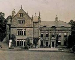
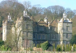
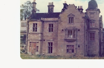
Brymbo Hall, one of Britain's lost houses, was a manor house located near Brymbo outside the town of Wrexham.The house, reputed to have been partly built to the designs of Inigo Jones,was noted as the residence of 18th-century industrialist and ironmaster John "Iron-Mad" Wilkinson.
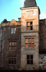
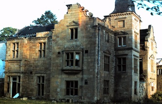
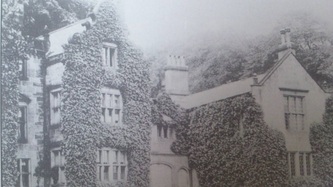
The estate was located on the upland moors around 3 miles (4.8 km) north-west of Wrexham. Its early history was relatively obscure, the deeds having been destroyed in a fire in 1794, though it was thought a house on the site had been constructed in the late 15th century for Edward ap Morgan ap Madoc, gentleman.Edward's son, Gruffydd, founded the locally-prominent Griffith family in the early 16th century, and a more modern house was built in 1624 for Edward's descendant John Griffith. A persistent local tradition claimed that not only had Inigo Jones designed the 1624 building, but that he had been born at the old Brymbo Hall (little is recorded of Jones's early life but he is generally thought to have been born in London, though he was of Welsh descent).However, a portico at the house dated 1624 was more firmly attributed to the architect,though it was later noted that the aedicular doorway was in fact a copy of Plate 158 in Sebastiano Serlio's Fourth Book, theRegole generali d'architettura (1537).Jones was also considered to have designed the chapel set in the grounds of the house.The main 1624 building was later extended by an eastern wing featuring a giant order of Doric pilasters. In 1649 Brymbo Hall was acquired by Sir Richard Saltonstall, an early settler in New England, on his return to Britain.By the close of the 17th century it was again occupied by the Griffith family, being owned by Robert Griffith, Esq, who served as High Sheriff of Denbighshire in 1684-5. Robert's only son John matriculated fromChrist Church, Oxford in 1695, aged 18; but appears to have died, without issue, before his parents, as the property was inherited by Robert's daughter Mary. As a highly marrieageable heiress, Mary married Robert Jeffreys of Acton Hall and after his death married again, to Richard Clayton of Lea Hall in Shropshire.She then married a third time, to Arthur Owen, a member of the Owen family of Brogyntyn.Her daughter Jane Clayton married Watkin Wynne of Voelas; their daughter, Elizabeth Wynne, married Thomas Assheton Smith I.During the mid-18th century the estate was the subject of several lawsuits between relatives of Arthur Owen and Richard Clayton. John Wilkinson bought the 500-acre (2.0 km2) Brymbo Hall estate in 1792 for the sum of £14,000. The land was rich in coal and ironstone deposits, and Wilkinson constructed an ironworks (later to become the Brymbo Steelworks) near the Hall. His son occasionally lived at the property after his death,and the estate was later to be managed by William Legh, Esq, the father of William Legh, 1st Baron Newton. However, the estate was sold off to pay the costs of a complex and long-running lawsuit between Wilkinson's heirs; by 1841 it had been purchased by the barrister Robert Roy, one of the original trustees appointed on Wilkinson's death.Roy, along with Henry Robertson and others, formed the Brymbo Mineral & Railway Company and restarted iron production on the estate. The house itself was later to be occupied by the Darby family, the descendents of Abraham Darby III, who were appointed as the ironworks managers. During the late 19th century Brymbo Hall was the country home of the Liberal MP for Denbighshire, George Osborne Morgan: another Liberal MP, Christmas Price Williams, grew up there. The Hall was largely unoccupied after 1930 and gradually fell into disrepair. It became partly derelict after World War II, when it was used by the military, and its lower floors were used for keeping livestock by a local farmer. It was eventually demolished in 1973 when open cast mining was carried out on the site, and is still considered to be one of the most unfortunate architectural losses in Wales. In addition to the Inigo Jones tradition, a local story said the house, and the road leading to it, was haunted by a "grey lady" supposed to be the ghost of Jane Wynn, who lived there alone in the 18th century, following the death of her husband.Another tale concerned a room in which shutters would refuse to stay closed, following the death of the (apocryphal) daughter of a 19th-century owner. A stand of twelve trees in the grounds was known as the "Twelve Apostles" or "Twelve Disciples"; the trees were also eventually uprooted by the National Coal Board. |
Brymbo Steelworks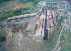
Brymbo Steelworks was a former large steelworks in the village of Brymbo.Many Broughton men and women were employed there. In operation between 1796 and 1990, it was significant on account of its founder, one of whose original blast furnace stacks remains on the site.
The works was founded by the pioneer industrialist John 'Iron Mad' Wilkinson. Wilkinson, who had owned the nearby Bersham Ironworks jointly with his brother William, purchased Brymbo Hall and its 500-acre estate from the Assheton-Smith family in 1792 for the sum of £14,000, some of which may have been lent by Boulton and Watt.The estate was rich in coal and ironstone deposits, several small coal pits having existed even before Wilkinson purchased the estate. By 1796 Wilkinson had erected the first blast furnace on the site, east of the Hall, 884 tons of iron being produced in this first year. This initial furnace ("No. 1") worked continuously until 1894 when it was finally 'blown out', and continued in use afterwards as a sand hopper. From 1805 a second furnace was brought into production. After Wilkinson's death, his estate was contested between his natural children, who he had fathered with the Brymbo Hall housekeeper Ann Lewis, and his nephew Thomas Jones. The cost of the actions in the Court of Chancery were to bankrupt Jones and to absorb much of the inheritance of Wilkinson's children. The ironworks lay idle for some years, with a few attempts at restarting production, one of which was made by the ironmaster John Thompson. In 1841, the works and estate were to be bought by Robert Roy (one of the Brymbo estate's trustees) and in 1842 were handed to Henry Robertson to develop.Robertson engaged William Henry Darby and Charles Edward Darby, grandsons of Abraham Darby III of Coalbrookdale, to manage the works.The works gradually expanded, and in 1854 he bought out Roy's share of the business, local tradition stating that the transaction was decided by a horse race which the steelworks employees, favouring Robertson, ensured he won. After the deaths of William and Charles Darby in 1882 and 1884 respectively, the business was incorporated as Brymbo Steel Co. Ltd. Robertson encouraged John Henry Darby, the son of William, and Peter Williams (father of the MP Christmas Price Williams, who was born at Brymbo) to trial steelmaking using the open-hearth process, and by January 1885 Brymbo had produced its first steel in a plant which was the first of its kind in the United Kingdom.The effects of the Great Depression caused the works to go bankrupt in 1931. The plant was saved, and production restarted, by Henry Robertson's son, Sir Henry Beyer Robertson (1862-1948). Robertson formed a new company and put Emrys Davies and Thomas Roberts in charge of production, as well as negotiating a lucrative contract to supply engineering steel for Rolls-Royce Limited aero engines.The business changed company name again in 1948, on the latter occasion becoming a part of GKN. From 1956 onwards the works were hugely expanded, new electric furnaces being sited on an artificial hill made from furnace waste. A further expansion in the early 1970s resulted in the construction of a large, modern rolling mill south of the main steelworks site. Brymbo was nationalised with the rest of the steel industry in 1967, becoming a division of British Steel Corporation.In 1978, the steelworks took its single automated blast furnace out of use, and concentrated on the production of high-quality steels from scrap metal. The works were served by the Wrexham and Minera Branch of the Great Western Railway, later of British Railways. During its history the steelworks was involved with or supported a number of other industrial sites in the immediate area, including collieries (with the Blast Pit being located within the works itself) and a brickworks at Cae-llo which produced firebricks until 1975. Steel production lasted until 1990, when the steelworks was closed by its then owners, United Engineering Steels. 1,100 jobs were lost. The site has now been developed to support large amounts of housing. It is currently planned to keep the long standing Machine Shop and No 1 blast furnace, both original buildings. |
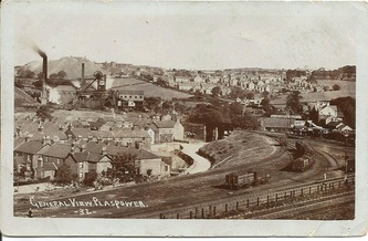
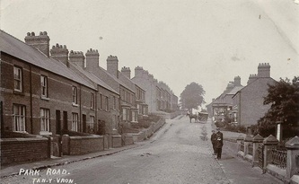
Tanyfron
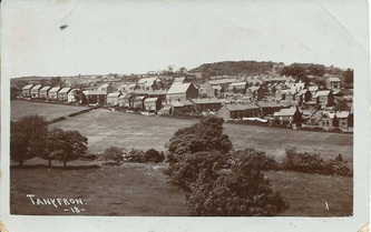
Tanyfron, also occasionally spelt Tan-y-fron, is a small village 3 miles west of Wrexham . At the time of the 2001 census, the population of area Wrexham 006A, which includes Tanyfron and a number of other small settlements, was 1,347.The village is part of the local government Community of Brymbo and is in the Vron electoral ward.
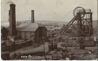
Tanyfron developed largely in order to provide accommodation for the families of miners. The shafts of the Vron Colliery, immediately to the west of today's village and named for the adjacent Vron Farm, were first sunk in 1806 by Rogers of Coedpoeth;it was purchased in 1840 by the surveyor and engineer William Low.
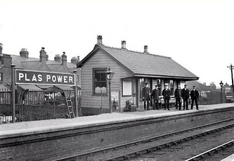
The initial small settlement of miners' houses, called Vron (an anglicised version of the Welsh word fron, "hillside", "slope"), was joined in the 1890s by a larger village to the east called Tan-y-fron ("under the hillside").Most of the residents worked in the collieries at Vron or Plas Power, or in the nearby Brymbo Steelworks.
A church dedicated to St. Alban was opened in 1897 as a "chapel of ease" for the parish church at Southsea.There were also formerly two nonconformist chapels, Mynydd Seion (Wesleyan, built in 1896) and Cana (Congregationalist).
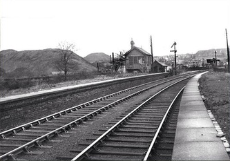
The colliery was served by two railways, a spur of the Great Western Railway's Wrexham and Minera Branch and a branch of the Wrexham, Mold and Connah's Quay Railway. The embankment of the latter is now a footpath still known locally as "the Line".
The Vron Colliery suffered financial problems throughout its history and was eventually closed in 1930;the colliery spoil tips, known locally as the "Bonc" (from the Welsh word for "hillock"), were finally cleared in the late 1980s. The major local employer, the Steelworks, expanded across the hillside to Tanyfron in 1976, but closed in 1990 with serious economic effects for the village.
Harold Tudor (1908-1988), the British Council official credited with starting the Llangollen International Musical Eisteddfod, was born in Tanyfron, where his parents lived on St Alban's Road.
Tanyfron still has both a small primary school and St. Albans church. Some housing development has taken place in the village, and in the village of Vron, during the 1990s and after. This led to protests in 2006 when the former school playing field was sold off for residential development.
As of 2010, St Albans church has been closed, and has been put up for sale by the Church in Wales.
Gwersyllt
Gwersyllt is a densely populated village,one of Wrexham's largest and is situated in the north western suburbs of the town, bordering the nearby villages of Llay, Cefn-y-Bedd, and Sydallt. The community, also including the villages of Summerhill and Bradley, had a total population of 10,056 at the 2001 census.
The name is usually stated to be derived from the Welsh word, gwersyll, meaning "campsite", with the final t common in the area's dialect.This is, however, a comparatively modern form, and during the mediaeval period the name was written as "Wershull" or "Wersull", with "Gwershull" and "Wersham" occurring in the 16th century. It is therefore possible that the present name, like others in the area, is a Welsh adaptation of an earlier English name ending in "-hull" (i.e. "hill").
Gwersyllt was originally a township of the parish of Gresford, and by 1833 had 834 inhabitants. The gradual increase of the area's population in the industrial era led to Gwersyllt being formed as a new parish in 1851, combining the old township of Gwersyllt and parts of the neighbouring township of Stansty. The parish church, from plans by Thomas Penson, was consecrated at the same time.
The village grew rapidly with the local coal mining industry and the area was home to several collieries, of which many features still remain. In 1896, the Gwersyllt coal mine owned by Edward Griffiths had 185 employees with 167 below ground. It was in operation by 1881.
The area was situated between the collieries of the Moss Valley and Bradley, and it also had good infrastructure links, which included local railway (which is still in use), and prior to that, a section of canal, originally intended to form part of the Ellesmere Canal. A local street is named, Heol-y-Camlas, meaning Canal Road. Evidence of the canal cuttings can still be seen along the lane that links Bottom Road with Mold Road (at the Sydallt exit).
In the mid-20th century, large council estates were built amongst the existing Victorian buildings. The area quickly gained popularity, and local services, including the local Holy Trinity School (which later became Ysgol Bryn Golau and Ysgol y Drindod, and which merged in 2005 to become Ysgol Heulfan), and Ysgol Bryn Alyn were built. Other local schools included Gwersyllt County Primary School and Ysgol-y-Gaer, who also merged in 2007.
A number of leisure and lifestyle facilities are available for local residents. Gwyn Evans Sports Centre, named after a local councillor and school teacher, is a council-operated leisure centre, consisting of a 25-metre swimming pool and multi-use sports hall, within the grounds of local secondary school, Ysgol Bryn Alyn. The school additionally offers an outdoor astroturf multi-use games area, situated adjacent to the leisure centre. The newly-built Gwersyllt Community Resource Centre provides a large bookable function hall and meeting rooms, along with Gwersyllt Library, which is open six days a week.
A number of public houses have been central to the area, including The Wheatsheaf and Gwersyllt Working Men's Club, along with those in the wider Gwersyllt Community in Summerhill, Bradley and Gresford.
Gwersyllt's largest shopping centre is known locally as the Kwik Save Centre, an outdoor precinct formally headed by the Kwik Save supermarket chain. Today it consists of Home Bargains, Iceland and a number of local retailers. German discount supermarket Lidl also operates a store adjacent to Gwersyllt railway station, along with a number of locally owned shops, food outlets and hairdressers around the community.
Gwersyllt's former heavy industries of coalmining and manufacturing have declined over the 20th Century. Much of the former land of these industries has been reclaimed, mostly as housing. However a number of industrial warehouses continue, namely of building supplies, car sales and double-glazing window manufacturing. The Studios is the headquarters of the former Marcher Radio Group, which produces and broadcasts radio programmes to the local Capital FM stations, formally Marcher Sound, Buzz 97.1, Coast 96.3, Champion FM 103, along with Wrexham and Chester Gold (formerly Classic Gold).
The A541 road, locally known as the Mold Road is the main thoroughfare into Wrexham southbound, and northwards through south Flintshire onto Mold. The community is also nearby to the A483 road via the Gresford and Wrexham junctions.
Gwersyllt railway station provides hourly services by rail on the Borderlands Line, southbound to Wrexham Central, and northbound onto Bidston, changing for Merseyrail services to Liverpool Central. All services are operated by Arriva Trains Wales, predominately using Class 150 and Class 153 diesel multiple units.
Public bus transport is provided by Arriva Buses Wales and GHA Coaches on services from Wrexham to Summerhill and Mold on Monday to Saturdays. A reduced service operates on Sundays and bank holidays, subsidised by Wrexham Council and provided by Arriva.
Gwersyllt Hill Hall
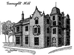
Gwersyllt Hill Hall,also known as 'Harrop's Hall',' Dracula's Castle' (Drac's Castle) and Penson's Hall was owned by Richard Kirke who also owned Bryn Mally Hall. Richard Kirke arrived in the Wrexham area in about 1775 and made his first home "near the Wheatsheaf" at Gwersyllt. Whether this was the property known as Gwersyllt Hill Hall is unknown.
Kirke was the father of five sons and several daughters, only one of whom used the same spelling of his surname. All the others used the spelling Kyrke. The one exception his infant daughter Mary whose early death is recorded on a gravestone, now used as paving, at the Dissenter's Cemetary at Rhosddu.
In 1812, Richard Kirk and Sir Watkin Williams Wynn made an exchange of areas of lands as a result of which that area known as Pendwll in the Moss Valley became part of Richard Kirk's estate.
Richard Kirke died at Gwersyllt Hill Hall on the 13th September 1839 aged 91 and he left the lands called Brynmally and Brynmally colliery to his son George Kyrke. The mansion known as Gwersyllt Hill Hall passed to his daughter ,Frances and her husband Thomas Penson after which time the house was known as Penson's Hall. A nearby crossroads is still called Penson's Turning.
Other occupants included James Sparrow J Arthur Harrop and finally Summerhill Social Club which at this time the property was known locally as Dracula's Castle.
Picture by John Bagshaw 1992
Summerhill
Summerhill (Welsh: Brynhyfryd, is a semi-urban village in the suburbs of Wrexham and forms part of the community of Gwersyllt. Smaller, more rural settlements within the village include Little Mountain and Windy Hill.
In the 19th and early 20th century, Summerhill was predominately focused around local farming or coalmining industries, however there was also nearby Brymbo Steelworks and Bersham Ironworks for those who could travel.
The nearest colliery was Westminster Colliery, located within the Moss Valley. Most of the area's coalmining industry was closed by the mid 20th century. Remnants of the area's former industrial history include disused features such as railway trackbeds, bridges and tunnels, particularly surrounding the Moss Valley areas.
Throughout the 1970s and 1980s, a number of housing developments increased the local population and the overall size and shape of the village. Pendine Park, in the south of the village closer to Wrexham, is the largest development in the region, consisting of private homes built in the 1970s, followed by adjoining Stansty Park and Glascoed Park, erected in the 1980s. Other developments in the northern higher areas of the village include White Lion Estate, also built in the 1980s, and more recent developments including Summerhill Park and Westminster Rise, built in the 21st Century.
Rhostyllen
Rhostyllen is a village south-west of the town of Wrexham. At the time of the 2001 census, area Wrexham 014A, which includes Rhostyllen itself, had a population of 1,383 in 599 households.Its name may be derived from the Welsh words rhos ("moor", or "rush pasture") and estyll ("staves" or "planks").
Rhostyllen was a part of the old township of Esclusham Below (i.e. "below" Offa's Dyke) and in 1879 was incorporated into the new ecclesiastical parish of Esclusham. The parish church, Holy Trinity, was completed in 1877.The corresponding civil parish of Esclusham became the community of Esclusham in 1974.
Rhostyllen is a former mining village, with Bersham (or Glanyrafon) Colliery, which before closure in December 1986 was the last working coal mine in the Denbighshire coalfield, situated to the east of Wrexham Road. Like other villages in the area, many of its buildings are nineteenth-century miners' houses built in the distinctive local "Ruabon Red" brick. This character is under threat as the village becomes increasingly linked to the outskirts of Wrexham by infill and commercial development along the A483 road.
The focal point of the village is the village hall, built in 1924, and its recreation grounds.
Rhostyllen's railway station was closed to passengers as long ago as 1931; the village was also formerly served by the line of the Wrexham and District Electric Tramway Company, opened in 1903, which ran from Penybryn in Wrexham to Johnstown and Rhosllanerchrugog: the halfway passing loop was situated at the Black Lion in Rhostyllen.
The eighteenth-century house and parkland at Erddig, now owned by the National Trust, is nearby.
Johnstown
Johnstown is a village two miles south west of Wrexham, and forms part of the old coal mining community of Rhosllannerchrugog.
The disused coal mine at Hafod is situated to the east of the village and the mine's former coal tip has now been converted to a country park, Bonc yr Hafod. The nearby clay quarry is currently used as a landfill site for waste from Liverpool.
The village has approximately 4,000 inhabitants, living in 1,300 households which are split into three main areas, the Moreton Estate, Nant Parc and the older part of the village (taken from police figures).
Johnstown is a located on the historic earth work of Offa's Dyke.
There are two schools in Johnstown: Johnstown Infants School and Johnstown Junior School.
There are four public houses in Johnstown; the New Inn; the Traveller's Rest; the Moreton Inn and the Grapes
Rhosllannerchrugog
Rhosllannerchrugog (occasionally written in English as Rhosllanerchrugog) is a large village two miles south west of Wrexham.
Literally translated the name comes from the Welsh: rhos "moor"; llannerch "glade"; grugog "heathery" hence "Moor of the Heathery Glade." It is often known simply as Rhos.
With a population of approximately 10,000 the modern community of Rhosllannerchrugog is one of the largest in Wales.The village was originally within the ancient parish of Ruabon and the district was referred to as Morton Above (i.e. Morton, or moor town, above Offa's Dyke) or Morton Wallichorum (the Welsh Morton). In 1844 Morton Above became part of the newly created parish of Rhosllannerchrugog.
The development of the village can be attributed largely to the coal seams of north-east Wales that pass beneath it, leading to the establishment of a large coal mining community during the 18th century. A symbol of Rhos' coal-mining and labour movement heritage is seen in the "Stiwt", the miners' institute on Broad Street. This was erected and paid for by the miners, during the general strike of 1926, as a social and cultural centre for the community.
The Welsh Religious Revival of 1904 had a major impact on Rhosllannerchrugog. The famous bardic line Beibl a Rhaw i Bobl y Rhos ("a Bible and a Spade for the People of Rhos) reflect the importance of both coal-mining and the chapels on the village's culture and heritage.
The - predominantly Welsh language - churches and chapels impacted greatly on the linguistic and cultural profile of the area, and until the early 1980s chapel-going was significantly higher in Rhos than in most other parts of Wales or the UK.[One result of this is that although only nine miles from the English border and surrounded by English-speaking villages,
Welsh is still spoken as a community language in Rhosllannerchrugog.
A weekly newspaper, the Rhos Herald, was founded by Richard Mills in 1894. Originally from Llanidloes, he set up his printing business in Hall Street. 3,737 issues were published from 18 August 1894 to 31 December 1966. Since the mid-1970s, a Welsh-language community newspaper featuring local news and other features, Nene, has been produced in the village.
The 2001 Census showed that approximately 40% of the village is Welsh speaking.
Rhosllannerchrugog hosted the National Eisteddfod in 1945 and 1961, and the Celtic League was founded there in 1961 during the Eisteddfod. This event was immortalised in the poem and song "The Cross Foxes" by Harri Webb, remembering the night when In Rhosllannerchrugog we drank the pub dry.
Ruabon
Ruabon is a village and community south west of Wrexham.
More than 80% of the population of 2,400 were born in Wales with 13.6% speaking Welsh.
The name "Rhiwabon" comes from "Rhiw Fabon", "Rhiw" being the Welsh word for "hill" and "Fabon" being a mutation from St Mabon, the original church name, of earlier, Celtic origin.An older English spelling, Rhuabon, can sometimes be seen.
There is evidence that a settlement existed in Ruabon in the Bronze Age. In 1898, building works in the centre of Ruabon exposed a cist or stone urn containing cremated human remains dating from 2000 years BC. In 1917, the remains of a Bronze Age round barrow were discovered on the playing fields of Ruabon Grammar School; they contained human remains, a flint arrowhead and a bronze axe.
Overlooking Ruabon is Y Gardden, an ancient hill fort surrounded by circular ditches, dating back to the Iron Age.
The ancient parish of Ruabon was made up of the townships of: Ruabon (which also included the hamlets of Belan, Bodylltyn, Hafod and Rhuddallt); Cristionydd Cynrig (also known as Y Dref Fawr or Cristionydd Kenrick in English); Coed Cristionydd; Cristionydd Fechan (also known as Y Dref Fechan orDynhinlle Uchaf); Dinhinlle Isaf; Morton Anglicorum (the “English Morton” or Morton Below the dyke); and Morton Wallichorum (the “Welsh Morton” or Morton Above the dyke).
In 1844, Coed Cristionydd and part of Cristionydd Cynrig became part of the new parish of Rhosymedre; and Cristionydd Fechan and Moreton Above became part of the new parish of Rhosllannerchrugog. Later in 1879, Dynhinlle Uchaf and the remainder of Cristionydd Cynrig became the new parish of Penycae.
Ruabon was in the historic county of Denbighshire and, between 1889 and 1974, was administered by Denbighshire County Council. From 1974 until 1996, it was administered as part of Clwyd. From 1996, it has been administered as part of the County Borough of Wrexham.
In the 1850s the English writer George Borrow toured Wales and wrote an account of his journey in the book “Wild Wales”:
“Rhiwabon … a large village about half way between Wrexham and Llangollen. I observed in this place nothing remarkable, but an ancient church. My way from hence lay nearly west. I ascended a hill, from the top of which I looked down into a smoky valley. I descended, passing by a great many collieries, in which I observed grimy men working amidst smoke and flame. At the bottom of the hill near a bridge I turned round. A ridge to the east particularly struck my attention; it was covered with dusky edifices, from which proceeded thundering sounds, and puffs of smoke. A woman passed me going towards Rhiwabon; I pointed to the ridge and asked its name; I spoke English. The woman shook her head and replied "Dim Saesneg" (English: "No English"). "This is as it should be", said I to myself; "I now feel I am in Wales."
Penycae
Penycae is a village three miles south west of Wrexham.
The village was part of the ancient parish of Ruabon and the district was known as Dynhinlle Uchaf (but also known as Y Dref Fechan or Cristionydd Fechan).
The new parish of Penycae was formed 1879, from parts of the existing parishes of Ruabon, Rhosllannerchrugog and Rhosymedre. The parish church of St. Thomas had been consecrated in 1878. However, most of the population of the parish were nonconformists and attended the Baptist chapels of Salem and Sion in Groes; the Calvinistic Methodist chapels in Groes and Tainant; the Wesleyan chapel of Soar in Stryt Issa; or the Primitive Methodist chapel in Copperas.
Coal was extracted from pits at Plas Bennion, Wynn Hall, Afon Eitha, Cristionydd, Groes and Plas Isaf. Zinc was worked at Copperas.
Most inhabitants find employment outside the village in Wrexham with only a few local shops or public buildings providing jobs.
Dee Valley Water operat
es two reservoirs in Penycae: Penycae Upper and Penycae Lower.
Valle Crucis Abbey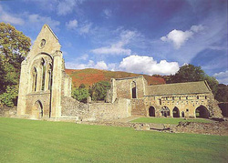
Valle Crucis Abbey was founded in 1201 by Madog ap Gruffydd Maelor, on the site of a temporary wooden church and was the last Cistercian monastery to be built in Wales. Originally founded in the principality of Powys Fadog, Valle Crucis was the spiritual centre of the region, while Dinas Bran was the political stronghold.The abbey took its name from the nearby Pillar of Eliseg, which was erected four centuries earlier by Cyngen ap Cadell, King of Powys in memory of his great-grandfather, Elisedd ap Gwylog.Madog was buried in the then-completed abbey upon his death in 1296. His heraldic slab was excavated from the site in 1956. Not long after Madog's death, it is believed that a serious fire badly damaged the abbey, with archaeological evidence that the church and south range were effected.The location on which Valle Crucis was raised was originally established as a colony of twelve monks from Strata Marcella,an earlier abbey located on the western bank of the River Severn near Welshpool.The original wooden structure was replaced with stone structures of roughly faced rubble. The completed abbey is believed to have housed about sixty brethren, 20 choir monks and 40 lay-members who would have carried out the day-to-day duties including agricultural work. The numbers within the church fluctuated throughout its history and the monks and the abbey itself came under threat from various political and religious events. The abbey is believed to been involved in the Welsh Wars of Edward I of England during the 13th century, and was supposedly damaged in the uprising led by Owain Glyndŵr. Numbers also fell after the Black Death ravaged Britain.The fortunes of Valle Crucis improved during the 15th century, and the abbey gained a reputation as a place of hospitality. Several important Welsh poets of the period spent time at the abbey including Gutun Owain, Tudur Aled and Guto'r Glyn.Guto'r Glyn spent the last few years of his life at the abbey, and was buried at the site in 1493.
In 1537, Valle Crucis was dissolved, as it was deemed not prosperous compared to the more wealthy English abbeys. After the Dissolution of the Monasteries, the site fell into disrepair, and the building was given to Sir William Puckering on a 21 year lease by Henry VIII. The lease was renewed under the reign of Henry's son Edward VI in 1551, but after Sir William's death in 1574, the property was passed to his daughter, Hestor. In 1575 Hestor married Edward Wotton, 1st Baron Wotton, and the lease was extended to Baron Wotton in 1583 by Elizabeth I. By the late 16th century the eastern range was converted into a manor house. Valle Crucis remained with the Wotton family, and was inherited by the2nd Baron Wotton, but upon his death it was passed to Hestor Wotton, his third daughter. Hestor married Baptist Noel, 3rd Viscount Campden and the abbey entered the family's ownership, before being sold shortly afterwards when the estate was sequestered by Parliament in 1651.By the late 18th century the building that remained were re-roofed and the site was used as a farm, before excavations were undertaken in the later half of the 19th century. The site is now cared for by Cadw, and is an open visitor attraction. Valle Crucis Abbey consisted of the church plus several adjoining out buildings which enclosed a square courtyard. The church itself ran West to East in the traditional cruciform style, today much of the original church is ruined, though the west end front wall survives, including the masonry of the rose window. The outbuildings including the adjoining east range, which survives mainly intact and the west range, which housed the lay brethren’s frater, but is now demolished. Completing the four sides of the inner courtyard was the southern frater and kitchen, which faced the church; these two building are also now ruins, with only foundation stones remaining. The east and west ranges housed the cloisters, with the east range also leading to the final structure, the abbot's lodgings which settled between the range and the church but outside the courtyard. The site is also home to the only remaining monastic fishpond in Wales, but suffered from being remodelled as a reflecting pool in the 18th century. As well as the west end front wall, extensive parts of the east end of the structures survive to the present day. The chancel walls, the southern part of the transept, the east range of the cloister together with the chapter house and sacristy and the lower part of the reredorter all survive mainly intact.In 1870 the west end wall was restored byGeorge Gilbert Scott. |
Castell Dinas Bran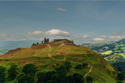
Castell Dinas Brân is a medieval castle standing high on a hill above the town of Llangollen.It is also the site of an Iron Age hill fort.
The first building placed at Dinas Brân was not the castle which now stands in ruins on top of the hill but an Iron Age hillfort built around 600 BC. An earthen rampart was constructed probably topped by a wooden palisade and this was further protected by a deep ditch on the shallower southern slope. The walls of the hill fort encircled a village of roundhouses. Dinas Brân is one of many hill forts in this part of Wales; Moel y Gaer is just a couple of miles to the north-west near the Horseshoe Pass, and another is close by at Y Gardden in Ruabon to the east. There are many others on the Clwydian Hills further to the north and in the Marches to the south. Dinas Brân is in what was once the ancient Kingdom of Powys. The last Prince of Powys Gruffydd Maelor died in 1191 and the kingdom was divided into Powys Fadog in the north and Powys Wenwynwyn in the south. His son, Madog ap Gruffydd Maelor was lord of Powys Fadog and founded the nearby Valle Crucis Abbey. Although no archaeological evidence has been found some records suggest he ruled from Dinas Brân. If a structure did exist it would have been a wooden fortification probably consisting of a wooden palisade surrounding a hall and other buildings. These early records further say it was destroyed by fire and then the new castle was built on the same site, therefore little prospect for finding any archaeological evidence of the early building remains. An even earlier structure has been suggested, belonging to Elisedd ap Gwylog from the 8th century.It was this Elisedd who was responsible for the Pillar of Eliseg and is one of the founders of the kingdom of Powys, but again no physical evidence for any structure at Dinas Brân has been found. The castle visible today was probably built by Gruffydd II ap Madog son of Madog ap Gruffydd Maelor sometime in the 1260s. At the time Gruffydd II ap Madog was an ally of Prince Llywelyn ap Gruffydd Prince of Wales, with Powys acting as a buffer state between Llewelyn's heartland of Gwynedd and England. Dinas Brân was one of several castles being built following the signing of the Treaty of Montgomery which had secured Wales for Llywelyn, free from English interference. Indeed the castle at Dolforwyn Castle near Newtown ordered to be built by Llywelyn around the same time has some similarities to Dinas Brân and may have been the work of the same master masonGruffudd died in 1269 or 1270 and the castle passed down to his four sons. Madoc the eldest son was the senior, but each of the sons may have had apartments at the castle. The peace between Llewellyn and Edward did not last long and in 1276 war started between England and Wales. Edward's larger armies soon invaded Wales and the support for Llewellyn crumbled. Two of the brothers made peace with Edward, the second brother Llewellyn and Madoc. However, the castle was not in Madoc's control as the surrender document with the English refers to conditions relating to the recapture of Dinas Brân. Meanwhile Henry de Lacy, Earl of Lincoln arrived in Oswestry with forces to capture Dinas Brân. As soon as he had arrived he was told that the defenders of the castle, probably the younger brothers Owain and Gruffudd - who were still allies of Llewellyn Prince of Wales, had set fire to and abandoned the castle. The reason for this action is not clear but it may be that they had no confidence that they could defend the castle against the English forces, and did not want to let it fall intact into Edward's, or their elder brother's hands. The castle was not badly damaged, the fire being mainly limited to the timber structures within the walls and Lincoln recommended to King Edward that the castle be repaired and garrisoned with English troops. Edward placed some troops at the castle at least into the next year 1277 when Llewellyn sued for peace and ordered some repair work to be undertaken. The history of the castle during the final war which restarted in 1282 is not recorded. It may have been recaptured by the Welsh like many other castles in the early months of the war but ultimately the English were victorious. Madoc had by now died and the three surviving brothers all fought for the Welsh Prince but to no avail and following the end of the war in October 1282 and the death of Llewelyn Prince of Wales most of Powys Fadog and the castle was granted to John de Warenne, Earl of Surrey. Rather than rebuild Dinas Brân, De Warenne choose instead to build a new castle at Holt on the Flintshire, Cheshire border and Dinas Brân continued till the present day a picturesque and romantic ruin.. |
Froncysyllte
Froncysyllte commonly colloquially known as Fron, is a village near and stands on the banks of the River Dee and the Llangollen Canal.
It is situated on the main A5 road which runs from London to Holyhead.
Its name is derived from the Welsh word fron, meaning a hillside or slope, along with the name Cysyllte, one of the old townships of the parish of Llangollen. The anglicised spelling Vroncysyllte was commonly used until the mid 20th century.
Froncysyllte is situated in the farming landscape of the Vale of Llangollen, but first developed as a settlement of cottages for quarry, limekiln, brick and tile-workers during the nineteenth century.
The village was built on a high outcrop of limestone below several quarries; although the area's traditional industries have now gone, it still has a rich industrial archaeology.
Amongst the landmarks left around Froncysyllte by industrial development is the Pontcysyllte Aqueduct, a World Heritage Site, which was built by Thomas Telford in 1795 to carry the Llangollen Canal across the River Dee.
Plas Y Pentre
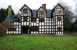
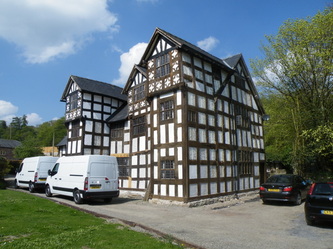
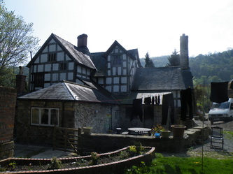
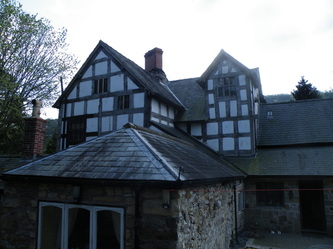
Plas Y Pentre is an historical building situated in the Vale of Llangollen about twelve miles south west of Wrexham.
Plas yn Pentre was a Grange belonging to Valle Crucis Abbey.
In a survey of 1291 it is described as: The Grange near the monastery, three ploughlands, mills and other conveniences.
On the dissolution of Valle Crucis Abbey in 1536 Plas yn Pentre came into the possession of the High Sheriff of Denbighshire,Ieuan Edwards.
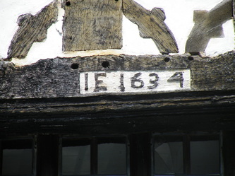
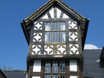
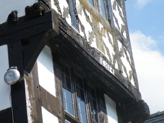
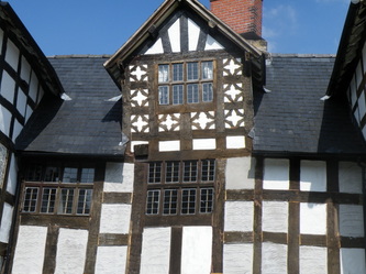
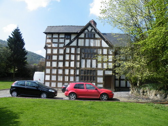
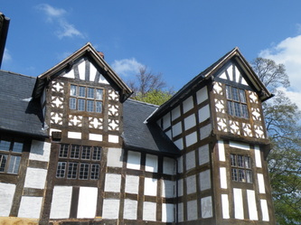
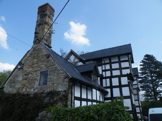
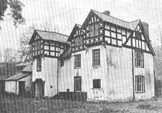
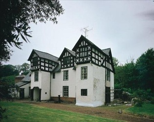
His grandson partially re-built the house in 1634 and his initials and the date can be seen carved into the exterior of the west gable (see photo's below)
In 1834 the house was bought by the Reverend T. Whitwell Rogers and it was during his ownership that
some loose boards in the floor disclosed three pieces of sculptured alabaster, two of which fitted together. These two pieces show a scene of the crucifixion and the other was described as ‘a scene in the life of St Arthmael, a south Wales saint’.
It is thought that the alabaster scenes were taken by the first Ieuan Edwards from the abbey after the dissolution.
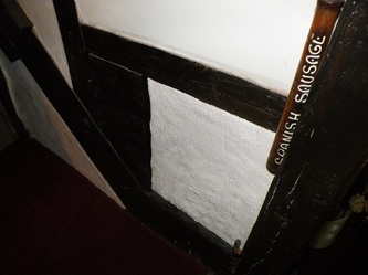
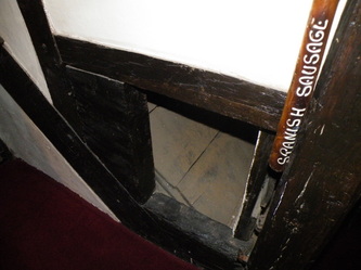
During the days of religeous persecution Plas Y Pentre enjoyed an exciting history,its priest's holes and secret passages being much used.Fragments of marble statuary dating from this period were later discovered in hiding places between the floors.
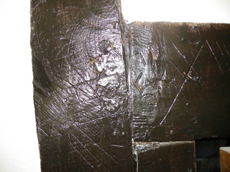
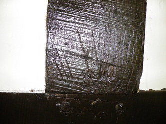
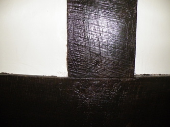
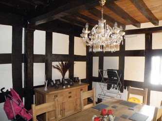
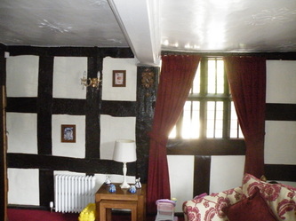
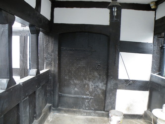
The wooden beams of the house were pure oak from an oak tree. The beams were cut and then marked with carpenters' marks. These were often Roman numerals. They helped the carpenter show where the beams fitted together.Carpenters would prepare and assemble the timbers of the frame in their own yard, marking the joints ready for assembly on sight. Beams, posts, joists and so on were mortised and tenoned while still on the ground.
The heavy joints were numbered with a system of Roman numerals usually made from a tool called a scribe.
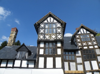
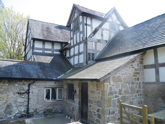
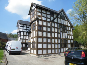
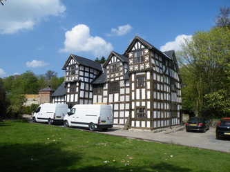
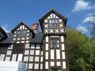
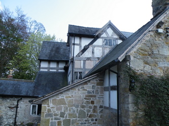
These may be later additions to a slightly earlier building. Constructed of an exposed timber box-frame, with lime-washed wattle-and-daub panels,slate roof and brick axial chimney-stack on stone base; the building is two-storey,
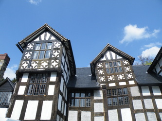
and has a three-bay centre section with a central gabled dormer flanked by projecting three-storey gabled outer wings with jettied top floors on decorated brackets.
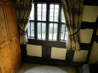
There is quatrefoil decoration to the 2nd floor panelling of the projecting gables and central dormer and restored windows with leaded panes.
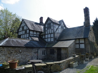
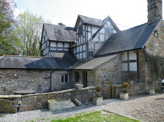
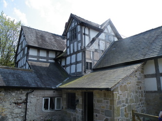
The arbitrary junction between the east projecting wing and the east gable suggest that wing has been added later, as has the projecting wing on the north side of house.
A stout, rendered masonry chimney-stack is inserted in north-east corner between the north wing and the main block.
A single-storey wing (Dining Room) with a roof dormer was added later to the west side of the original 17th-century block, probably built on the site of original service rooms.
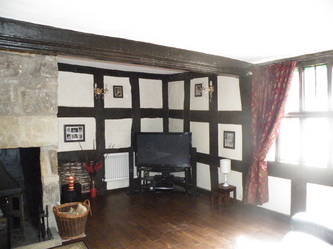
Internally, a recessed doorway leads from the porch to the end passage, now with partition removed,
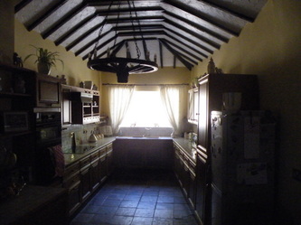
and a Living Room with a bevelled and moulded beam, which probably occupies the site of original 'hall'.
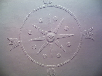
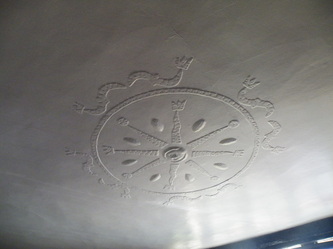
The parlour has a bevelled and moulded beam and a 'Jacobean' plaster ceiling with moulded patterns in low relief. There are plain stairs at the rear of the house.
